Rwenzori Mountains National Park
Rwenzori Mountains National Park - Uganda
About
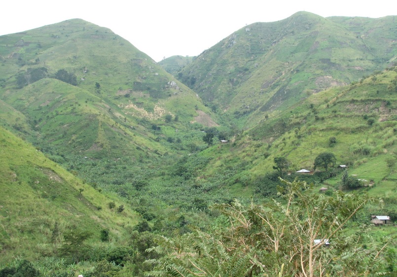
Popularly known as the Mountains of the Moon and was discovered by white explorers in 1889. Everyone from experienced hikers to casual day hikers find the Rwenzori Mountains National Park a magnificent environment, with its non-volcanic mountains capped with snow, massive ice-rime sculptures, awe-inspiring vegetation and unique fauna. The mountains are 120 kilometers long and 48 kilometers wide were forced up during the creation of the Great Rift Valley.
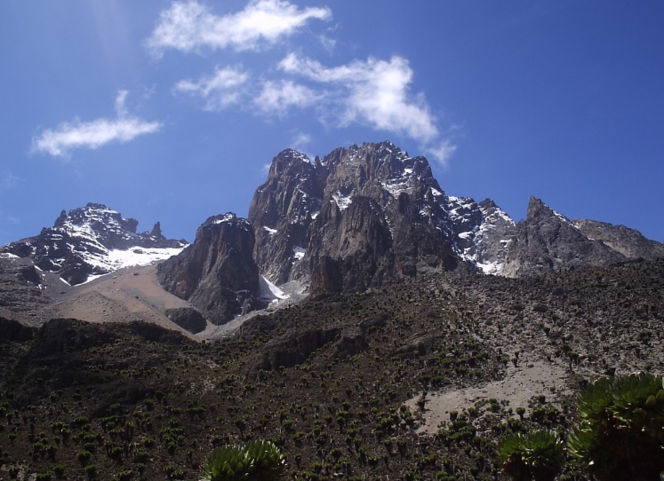
At the centre of the range are six snow capped peaks. The highest Mountain of the range, Mount Stanley is the third highest mountain in Africa after Mount Kilimanjaro and Mount Kenya. Mount Stanley’s highest peak, Margherita rises 5,109 meters above sea level. Other peaks in the range include Alexandria, 5,083 meters; Speke, at 4,890 meters; Emin at 4,791; Gessi at 4,715; and Luigi di Savoia at 4,627 meters. Interestingly more people visit the Rwenzoris to explore the vegetation than to climb the glaciers and peaks. Because of the strange evolutionary pattern, common plants grow to absurd proportions. Lobelias weigh in at 60 kilograms while heather shoots upto 10 meters.
The people on the lower slopes of the Rwenzori Mountain are the Bakonjo. Strong and energetic, they are well suited to life in the mountains, which are an integral part of their traditional beliefs.
Over 500,000 Ugandans living below the park boundary are dependent on the park watershed for year round agricultural production. Major crops include coffee, beans, maize, yams, Irish potatoes, and wheat.
Getting there
Ibanda, the nearest town to Nyakalengija Park headquarters (the starting point for climbing in the mountains), is about 69 kilometers from Fort Portal, 25 kilometers from Kasese, and 389 kilometers from Kampala. It is served by a good tarmac road from both Fort Portal and Kasese. The nearest large town Kasese was served in the past by rail from Kampala but has an airstrip in place to accommodate air charters.
When to go
Constant mist covers the mountains all year round. The driest months are usually July and August, and December to February. Visits at any other time might be disappointing.
Where to stay
The growth of the tourism ecosystem in Kasese region has led to the set-up of some great accommodation facilities at the foothills of the Rwenzori Mountains. Visitors have the option of choosing from lodges like Ihamba Safari Lodge, Equator snow lodge and budget options like Rwenzori Backpackers, Mihunga Safari Lodge, and Ruboni community camp.
Along the central hiking circuit, camping sites are available at convenient stopping points. Accommodation is also available in Kasese town.
Sightseeing
Head south out of Fort Portal town on Kyebambe road towards Kasese. About 5 kilometers out of town on the left side of the road, stand at the Karambi tombs, where Toro King Kasagama and his son Rukidi II are buried. There’s not much else to see before the Rwenzori Mountains National Park turnoff but the scenery along the way is beautiful, and you pass through several small towns. Some 54 kilometers from Fort Portal you come to the turn off to Ibanda and the Nyakalengija Park headquarters. From there its another 10 kilometers to Ibanda and another 5 kilometers through banana and sugar plantations before you reach Nyakalengija where the hiking trail begins.
The usual trip to Rwenzori Mountains lasts seven to nine days, which is just long enough to hike the well travelled central circuit trail. Shorter trips can also be arranged but they do not reach the high mountains. It is best to allow a minimum of six days even for shorter trips. No special climbing equipment is necessary unless you attempt one of the summits although you have to keep in mind that hiking is tough work, usually in poor weather and should not be taken lightly. Carry along a map or one of our knowledgeable guides can avail you with one. We recommend you but the Ruwenzori Map and Guide by Andrew Wielochowski.
Before you attempt a climb or high altitude hike, make sure you are aware of the dangers and symptoms of mountain or altitude sickness which can be fatal. These symptoms usually become noticeable after 3000 meters. Mild symptoms include headache, nausea, and slight loss of coordination. Severe symptoms include abnormal speech and behavior, severe nausea and headaches and persistent coughing spasms. If you have any of the severe symptoms, immediately descend to lower altitudes.
Be aware too of the dangers of hypothermia. You have to waterproof most of your items. Hypothermia occurs when the body temperature is lowered usually caused by a combination of wet and cold condition. Note that severe symptoms of hypothermia include disorientation, lethargy and mental confusion.
The central circuit is by far the most popular hike or climb. Like others it begins at Nyakalengija park headquarters and takes you through the Nyabitaba hut at 2,651 meters. It is a fairly easy walk of about four to five hours. On the way you pass through a small coffee plantation and meadow before hitting the bush and later the forest. Please wear long trousers as the nettles can be nasty. The trout filled Mubuku River is on your right as you start the journey. You cross a couple of streams and then the Mahoma River before climbing the ridge to Nyabitaba.
From Nyabitaba you can tackle the trail in either a clockwise or anticlockwise direction.
The next day’s hike on the anticlockwise circuit is tough, taking a minimum of seven hours before you reach the next night stop of John Mate Hut, at 3,505 meters. The path takes you down through the forest dropping steeply to Mubuku River, which you cross by the Kurt Schafer Bridge. You then climb up steeply up the bank and walk several kilometers through bamboo followed by another arduous ascent with many rocks on the path. There you begin to enter the Moorland zone and giant tree heathers are everywhere. Giant Groundsels also flourish. You will stop for lunch at the Nyamileju Hut.
From Nyamileju it is another two hours or so to the John Mate Hut through a giant heather forest following the course of the Bujuku River.
An alternative night stop is the Bigo Hut at 3,445 meters another kilometer or so of tough track through a bog, which often requires wading through deep mud or leap from one grassy patch to the next.
From Bigo the circuit trail heads south west. To continue on the circuit trail from the John Mate Hut on the third day you head towards the Bujuku hut at 3,962 meters. This may take up to six hours depending on the condition of the Bigo Bog which may be slow going if the mud is deep. You pass through another bog before reaching Lake Bujuku, majestically set against a backdrop of Mount Baker’s scree slopes and affording views of Mount Stanley and Mount Speke. If you intend to climb Mount Speke, make this you base, but you have to spend an extra night to do this. To scale the highest point in the Ruwenzoris you need to base yourself at Elena hut which is about two kilometers off the circuit trail and a three to four hour walk from the Bujuku Hut.
From Lake Bujuku head south to Lake Kitandara at 4,023 meters this takes you to the highest point on the circuit trail the Scott Elliot Pass at 4,372 meters. Kitandara Hut close to the foot of Elena Glaciers are positioned on the floor of Lake Kitandara. This idyllic spot is about a four hour walk from Lake Bujuku.
The following day you begin your descent to the east and head to Guy Yeoman Hut at 3,450 meters. You can also opt to stay the night at the Kabamba Rock Shelter which you reach first.
Plan on about a five hour hike: first a very steep ascent to fresh field pass and then a drop down to Bujongolo, a cliff over hang providing good shelter. After passing through the bog from Kabamba you come across the Yeoman Hut on a ridge above the stiff valley.
The next day which could be you final one on the circuit, you head down the steep valley through bamboo forests and bog across the Mahoma River and two minor streams, to the Nyabitaba Hut. This part of the journey should take about five hours. From there you can push on for another three hours to Nyakalengija base.
In addition to the many unusual plants you see on your journey down the circuit trail, you also may come upon some of the diverse birdlife and animal species that make this their base.
Primates and other mammals in the park include the Chimpanzee, Rwenzori Colobus Monkey, black and white colobus monkey. Blue monkeys, duiker, hyrax and serval.
Some unique birds in the Rwenzori include handsome francolin, olive pigeon, and white-necked raven.
Popular Safari Packages
The Rwenzori Mountains lie on the border of Uganda and the Democratic Republic of Congo on the flanks of the western section of the Great Rift Valley. This excruciating 14 day hiking tour covers vast sections of the hiking trail leading hikers to the snow capped Margherita peak on Mount Stanley. This is a physically demanding adventure and thus calls for some minimum levels of physical fitness.
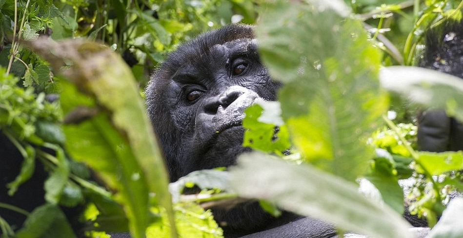
One of the most awesome, breathtaking experiences on earth is to observe a mountain gorilla in its natural habitat. Closely linked by DNA to humans with researchers estimating anywhere between 95-99% these charismatic herbivores can grow up to 6ft tall. This six day Gorilla tour is inclusive of a one day big 5 game drive of the Queen Elizabeth National Park in Western Uganda
Covering sections of the western part of the Great Rift Valley, this adventurous journey covers large sections of the National Parks in the western part of Uganda. This 13 day Gorilla and Wildlife Safari takes you into the heart of Uganda witnessing some of the greatest Wildlife spectacles nature has to offer. Besides viewing the Gorillas you will also be accorded the opportunity of viewing the elusive Shoebill Stork.
Short Tour Packages in Uganda
3 Days Lake Mburo NP Safari

Together with 13 other lakes in the area, Lake Mburo forms part of a 50km-long wetland system linked by a swamp. Five of these lakes lie within the park’s borders. This safari is ideal for travelers who are looking at combining a game viewing safari with a one day birding tour. Lake Mburo is located in Western Uganda and was originally gazetted as a game reserve in 1963
4 Days Murchison Falls NP Safari
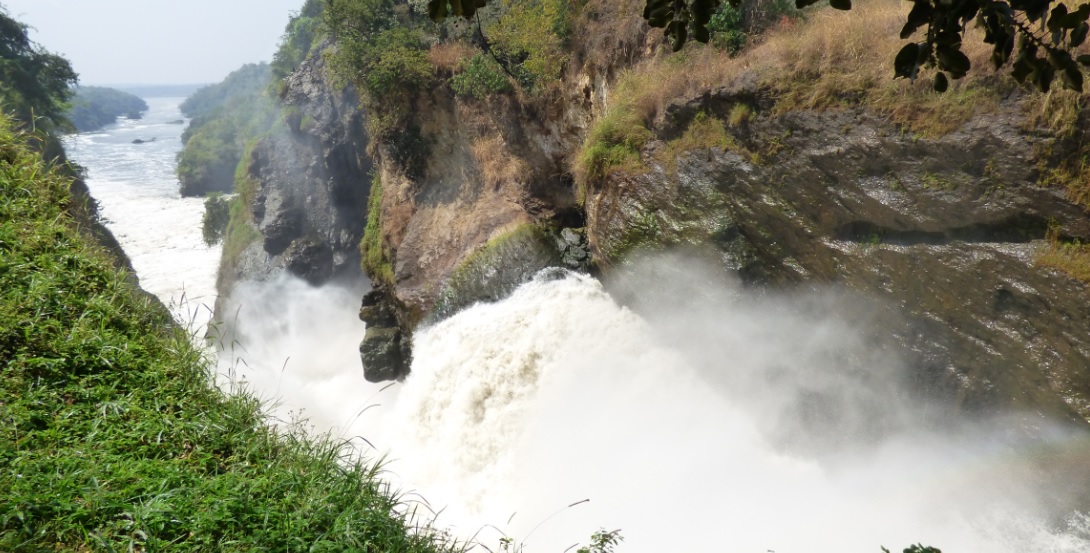
Murchison Falls Conservation Area ( MFCA ) comprises of Murchison Falls National Park, Bugungu and Karuma Falls Wildlife Reserves. This is where the Nile explodes through a narrow gorge and cascades down to become a placid river whose banks are thronged with hippos and crocodiles, waterbucks and buffaloes. This safari includes a brief stop over at the Ziwa Rhino Sanctuary.
4 Day Queen Elizabeth NP Safari

Queen Elizabeth National Park has a variety of Flora and Fauna and it’s acknowledged to be a habitat for over 95 mammal species with about 612 species of birds. The various species in this park, has made it a unique park most liked by tourists. This safari is an ideal Big Five game viewing safari with the tree climbing Lions offering some truly amazing spectacles.